Braughing: The Axe and Compasses
Introduction
The photograph on this page of Braughing: The Axe and Compasses by Nigel Cox as part of the Geograph project.
The Geograph project started in 2005 with the aim of publishing, organising and preserving representative images for every square kilometre of Great Britain, Ireland and the Isle of Man.

There are currently over 7.5m images from over 14,400 individuals and you can help contribute to the project by visiting https://www.geograph.org.uk
Braughing: The Axe and Compasses
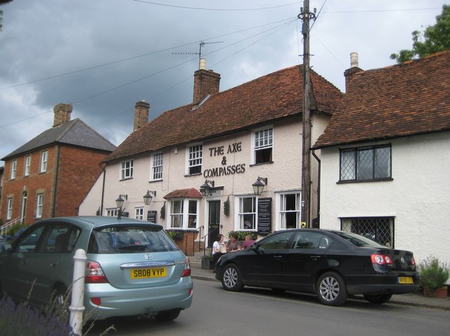
Image: © Nigel Cox Taken: 19 Jun 2011
Continuing on to the left from Image this pub was once a house, bucking the present day trend. It is thought that the name might derive from meetings of The Worshipful Company of Carpenters held here around 1800. Certainly up to 1921 the Ordnance Survey were showing the pub as The Axe and Compass, singular. This is yet again, like so many in Braughing, a Grade II Listed Building.
Images are licensed for reuse under creativecommons.org/licenses/by-sa/2.0
Image Location
Latitude
51.907895
Longitude
0.030576