Obscured benchmark on Russell Road, Rhyl
Introduction
The photograph on this page of Obscured benchmark on Russell Road, Rhyl by Meirion as part of the Geograph project.
The Geograph project started in 2005 with the aim of publishing, organising and preserving representative images for every square kilometre of Great Britain, Ireland and the Isle of Man.

There are currently over 7.5m images from over 14,400 individuals and you can help contribute to the project by visiting https://www.geograph.org.uk
Obscured benchmark on Russell Road, Rhyl
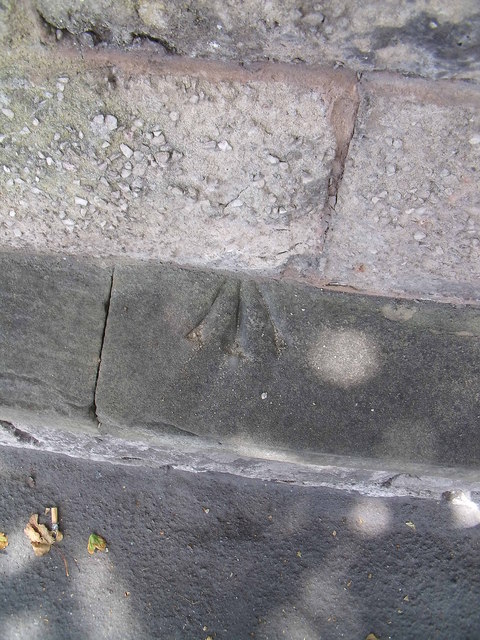
Image: © Meirion Taken: 28 Jun 2011
This benchmark is located on the NW side of Russell Road & close to the junction with Conwy Street. The mark is not recorded in the current OS database but is shown on an 1871 map of the area at a height of 25.1ft above the Liverpool datum. The mark is located on top of a wall which has a more recent wall built on top of it. The mark is therefore partially obscured. It is therefore difficult to classify the type of mark as it could be a rivet, pivot or indeed a toppled cut mark.
Images are licensed for reuse under creativecommons.org/licenses/by-sa/2.0
Image Location
Latitude
53.324704
Longitude
-3.482643