
Landscaping of the former A2 near Gravesend
Introduction
The photograph on this page of Landscaping of the former A2 near Gravesend by Marathon as part of the Geograph project.
The Geograph project started in 2005 with the aim of publishing, organising and preserving representative images for every square kilometre of Great Britain, Ireland and the Isle of Man.

There are currently over 7.5m images from over 14,400 individuals and you can help contribute to the project by visiting https://www.geograph.org.uk
Landscaping of the former A2 near Gravesend
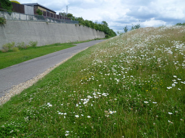
Image: © Marathon Taken: 24 Jun 2011
Between 2007 and 2009, the A2 from Ebbsfleet to Cobham underwent extensive works to move the entire carriageway south to run alongside the Channel Tunnel Rail Link, and to remove the road away from local housing. Here on the southern outskirts of Gravesend, the old six-lane carriageway has been landscaped and opened up as a pedestrian and cycle route. It is strange to stroll along what was until recently a very busy road and see wild flowers, although the wall of a cutting and old road markings are a reminder of what used to be here.
Images are licensed for reuse under creativecommons.org/licenses/by-sa/2.0
Image Location

Latitude
51.416159
Longitude
0.36294