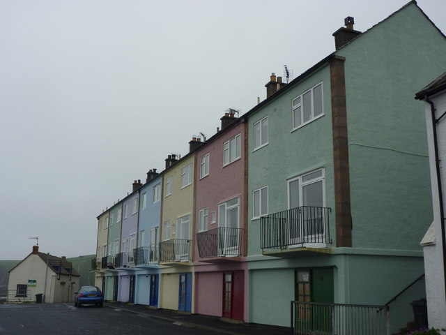
Berwickshire Architecture : 14 - 20 Lower Burnmouth
Introduction
The photograph on this page of Berwickshire Architecture : 14 - 20 Lower Burnmouth by Richard West as part of the Geograph project.
The Geograph project started in 2005 with the aim of publishing, organising and preserving representative images for every square kilometre of Great Britain, Ireland and the Isle of Man.
There are currently over 7.5m images from over 14,400 individuals and you can help contribute to the project by visiting https://www.geograph.org.uk

Image: © Richard West Taken: 21 Jun 2011
Architect : Basil Spence, 1948. Grade B listed. See Image and Image for other views and information. When I planned this morning's visit to Burnmouth I was unaware of the existence of these buildings. They were, therefore, an unexpected delight on a grim, wet and misty midsummer morning. As a resident of Dunbar (20 miles up the coast) I should be able to recognise the work of Spence when I accidentally stumble upon it!

