16th century tolls, White Hart, Crickhowell
Introduction
The photograph on this page of 16th century tolls, White Hart, Crickhowell by Jaggery as part of the Geograph project.
The Geograph project started in 2005 with the aim of publishing, organising and preserving representative images for every square kilometre of Great Britain, Ireland and the Isle of Man.

There are currently over 7.5m images from over 14,400 individuals and you can help contribute to the project by visiting https://www.geograph.org.uk
16th century tolls, White Hart, Crickhowell
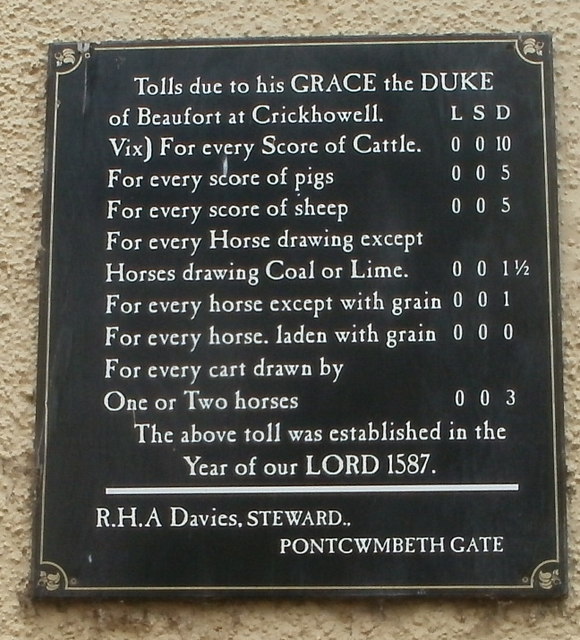
Image: © Jaggery Taken: 19 Jun 2011
This is one of two boards on the external walls of the White Hart. http://www.geograph.org.uk/photo/2468776 It records the tolls payable for using the road in the 16th century. At that time, the White Hart was a coaching inn and toll house. It may be a fairly recent recreation of an older sign, based on the modern-day spellings (though the use of capital letters appears idiosyncratic, with horse or Horse and Score or score used). Or it may be from perhaps the 18th century, if the tolls were unchanged since 1587.
Images are licensed for reuse under creativecommons.org/licenses/by-sa/2.0
Image Location
Latitude
51.864022
Longitude
-3.142863