Former drinking fountain, Crickhowell
Introduction
The photograph on this page of Former drinking fountain, Crickhowell by Jaggery as part of the Geograph project.
The Geograph project started in 2005 with the aim of publishing, organising and preserving representative images for every square kilometre of Great Britain, Ireland and the Isle of Man.

There are currently over 7.5m images from over 14,400 individuals and you can help contribute to the project by visiting https://www.geograph.org.uk
Former drinking fountain, Crickhowell
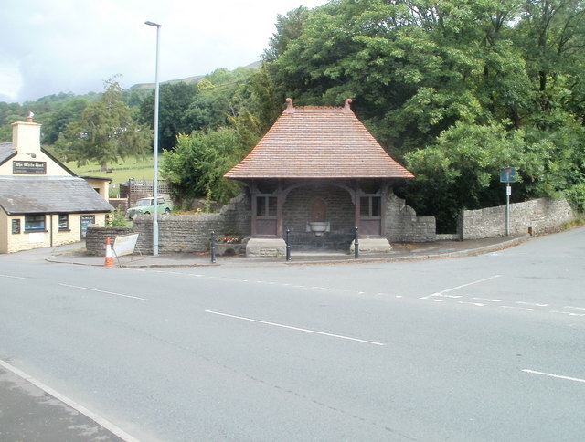
Image: © Jaggery Taken: 19 Jun 2011
Near the western edge of Crickhowell, a roofed structure encloses a drinking fountain http://www.geograph.org.uk/photo/291938 installed in the 1890s. The fountain is no longer in use. The gap in the wall on the right side of the structure leads down to Cwmbeth Brook.
Images are licensed for reuse under creativecommons.org/licenses/by-sa/2.0
Image Location
Latitude
51.864022
Longitude
-3.142863