Disused Railway tunnel, Tootal Heights
Introduction
The photograph on this page of Disused Railway tunnel, Tootal Heights by Peter Bond as part of the Geograph project.
The Geograph project started in 2005 with the aim of publishing, organising and preserving representative images for every square kilometre of Great Britain, Ireland and the Isle of Man.

There are currently over 7.5m images from over 14,400 individuals and you can help contribute to the project by visiting https://www.geograph.org.uk
Disused Railway tunnel, Tootal Heights
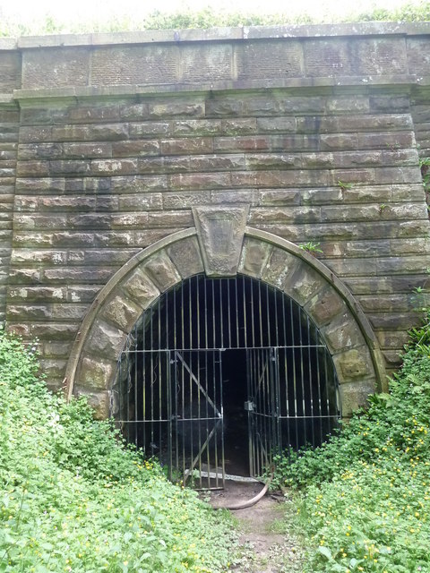
Image: © Peter Bond Taken: 17 Jun 2011
Tunnel, built under Tootle Heights in 1839, to access quarries beyond. Now disused and usually locked up. The Tunnel was 55 yards long but is now blocked at the far end by rubble. The keystone over the entrance reads P&LR (Preston & Longridge Railway)- 1839 -FHP CT (Fredrick Henry Park, the engineer, Cooper & Tullis, builders)
Images are licensed for reuse under creativecommons.org/licenses/by-sa/2.0
Image Location
Latitude
53.835172
Longitude
-2.591972