Church of St. Peter, Flawford
Introduction
The photograph on this page of Church of St. Peter, Flawford by Les Carruthers as part of the Geograph project.
The Geograph project started in 2005 with the aim of publishing, organising and preserving representative images for every square kilometre of Great Britain, Ireland and the Isle of Man.

There are currently over 7.5m images from over 14,400 individuals and you can help contribute to the project by visiting https://www.geograph.org.uk
Church of St. Peter, Flawford
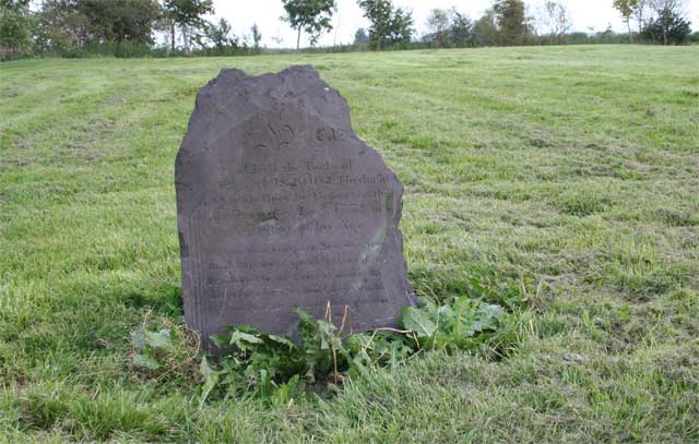
Image: © Les Carruthers Taken: 20 Sep 2006
The Church of St. Peter in Flawford was built in around 800 AD and was demolished in 1773/1779. This photo shows one of the few remaining headstones (dated December 3rd 1758) in the graveyard. The outline of the church is marked on the grass behind the gravestone.
Images are licensed for reuse under creativecommons.org/licenses/by-sa/2.0
Image Location
Latitude
52.892988
Longitude
-1.12002