Manswood, The Buildings
Introduction
The photograph on this page of Manswood, The Buildings by Mike Faherty as part of the Geograph project.
The Geograph project started in 2005 with the aim of publishing, organising and preserving representative images for every square kilometre of Great Britain, Ireland and the Isle of Man.

There are currently over 7.5m images from over 14,400 individuals and you can help contribute to the project by visiting https://www.geograph.org.uk
Manswood, The Buildings
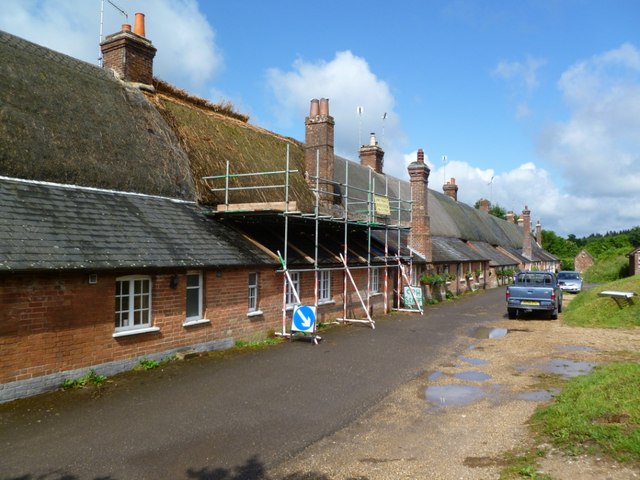
Image: © Mike Faherty Taken: 16 Jun 2011
A terrace of twelve thatched cottages, reputed to be the longest in England; C18, with later front additions. Originally estate cottages, listed by English Heritage: http://www.imagesofengland.org.uk/Details/Default.aspx?id=107403&mode=adv
Images are licensed for reuse under creativecommons.org/licenses/by-sa/2.0
Image Location


Leaflet Map data © OpenStreetMap
Latitude
50.872487
Longitude
-2.024535