Dredging Bredgar Pond
Introduction
The photograph on this page of Dredging Bredgar Pond by Penny Mayes as part of the Geograph project.
The Geograph project started in 2005 with the aim of publishing, organising and preserving representative images for every square kilometre of Great Britain, Ireland and the Isle of Man.

There are currently over 7.5m images from over 14,400 individuals and you can help contribute to the project by visiting https://www.geograph.org.uk
Dredging Bredgar Pond
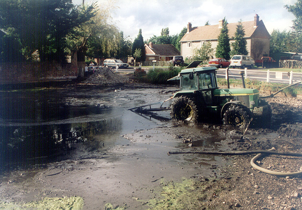
Image: © Penny Mayes Taken: Unknown
Algae bloom and an infestation of duck weed suggested something needed to be done so we caught the fish (for safe-keeping) and emptied the pond - sludge from the bottom was spread on a nearby field, a new island was built for the ducks and, so far, it all looks much healthier.
Images are licensed for reuse under creativecommons.org/licenses/by-sa/2.0
Image Location


Leaflet Map data © OpenStreetMap
Latitude
51.311653
Longitude
0.696085