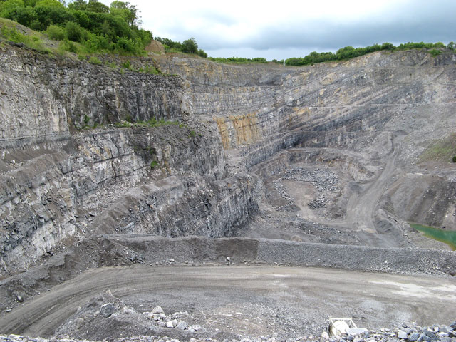
Aberduna Quarry
Introduction
The photograph on this page of Aberduna Quarry by Jonathan Wilkins as part of the Geograph project.
The Geograph project started in 2005 with the aim of publishing, organising and preserving representative images for every square kilometre of Great Britain, Ireland and the Isle of Man.
There are currently over 7.5m images from over 14,400 individuals and you can help contribute to the project by visiting https://www.geograph.org.uk

Image: © Jonathan Wilkins Taken: 11 Jun 2011
A view into the surprisingly deep quarry at Aberduna which is developed in the Carboniferous (Visean) limestone known as the Cefn Mawr Limestone. The steep, easterly dip is indicated by the thin beds with a darker and lighter colour. Pure beds are characteristically light in colour, with darker beds having a higher content of mud and organic material. At the left of the image it is possible to see the characteristic cyclic pattern of deposition of these beds, with at least three cycles visible in the middle part of the outcrop. Each cycle begins with a dark mudstone representing deepwater conditions that are unfavourable for the carbonate-secreting organisms, and as the water shallows progressively the amount of carbonate increases until clear, lagoonal and reef deposits dominate. This is a record of sea level changes over hundreds to thousands of years.

