Rockland Street, Belfast
Introduction
The photograph on this page of Rockland Street, Belfast by Albert Bridge as part of the Geograph project.
The Geograph project started in 2005 with the aim of publishing, organising and preserving representative images for every square kilometre of Great Britain, Ireland and the Isle of Man.

There are currently over 7.5m images from over 14,400 individuals and you can help contribute to the project by visiting https://www.geograph.org.uk
Rockland Street, Belfast
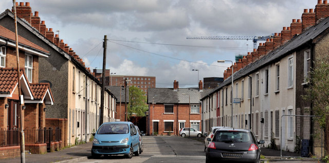
Image: © Albert Bridge Taken: 12 Jun 2011
A street of terrace house, off the Donegall Road, immediately to the west of Lower Rockview Street Image Most of the houses are blocked-up and awaiting demolition. Monarch Parade is in the background. Image shows the street on 8 April 2012 after Monarch Parade and the row on the right had been demolished. Image and Image show the street after rebuilding.
Images are licensed for reuse under creativecommons.org/licenses/by-sa/2.0
Image Location
Latitude
54.589301
Longitude
-5.95508