Harrow Weald Common: The Kiln Triangulation Pillar
Introduction
The photograph on this page of Harrow Weald Common: The Kiln Triangulation Pillar by Nigel Cox as part of the Geograph project.
The Geograph project started in 2005 with the aim of publishing, organising and preserving representative images for every square kilometre of Great Britain, Ireland and the Isle of Man.

There are currently over 7.5m images from over 14,400 individuals and you can help contribute to the project by visiting https://www.geograph.org.uk
Harrow Weald Common: The Kiln Triangulation Pillar
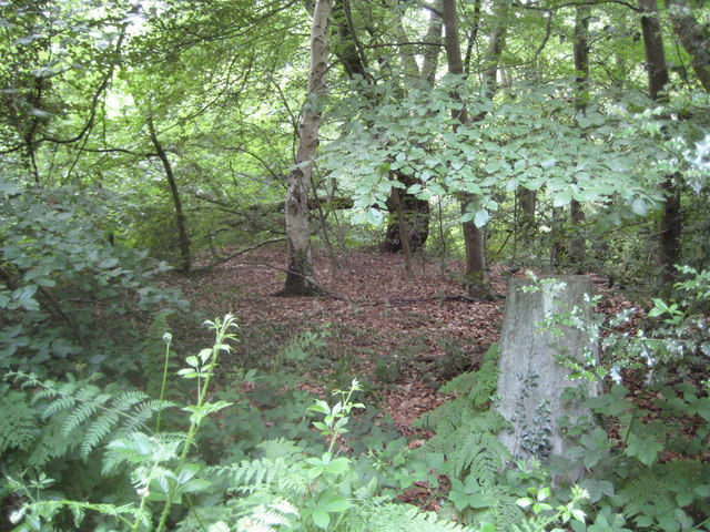
Image: © Nigel Cox Taken: 5 Jun 2011
Judging by the amount of vegetation that has grown up alongside and over it, it is unlikely that this Ordnance Survey triangulation pillar has been used for its original purpose by surveyors for many many years. Even knowing it was there from the map did not make it easy to find. However the Ordnance Survey website tells us that the flush bracket on the side was last levelled to Second Order standards by them in 1975, while 1982 was the last year it was maintained by them. The pillar is referred to as The Kiln by virtue of the old brick and tile works of the same name a short way to the south.
Images are licensed for reuse under creativecommons.org/licenses/by-sa/2.0
Image Location
Latitude
51.624173
Longitude
-0.3437