The Scrabo Road roundabout, Newtownards
Introduction
The photograph on this page of The Scrabo Road roundabout, Newtownards by Albert Bridge as part of the Geograph project.
The Geograph project started in 2005 with the aim of publishing, organising and preserving representative images for every square kilometre of Great Britain, Ireland and the Isle of Man.

There are currently over 7.5m images from over 14,400 individuals and you can help contribute to the project by visiting https://www.geograph.org.uk
The Scrabo Road roundabout, Newtownards
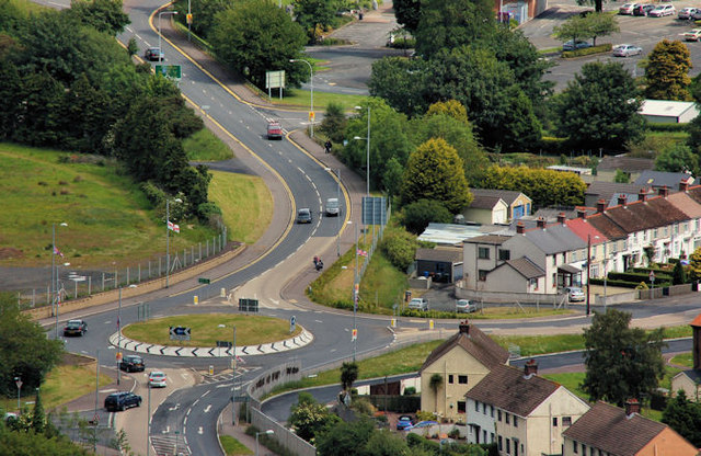
Image: © Albert Bridge Taken: 11 Jun 2011
The roundabout, on the Scrabo Road, was reputedly a late addition to the plans for the Newtownards inner relief road Image It does, however allow local residents to have direct access to the road and facilitates the journey from Belfast and Dundonald to Scrabo Tower (from where this view was taken).
Images are licensed for reuse under creativecommons.org/licenses/by-sa/2.0
Image Location
Latitude
54.589081
Longitude
-5.712028