Trent and Mersey Canal in Stoke-on-Trent
Introduction
The photograph on this page of Trent and Mersey Canal in Stoke-on-Trent by Roger D Kidd as part of the Geograph project.
The Geograph project started in 2005 with the aim of publishing, organising and preserving representative images for every square kilometre of Great Britain, Ireland and the Isle of Man.

There are currently over 7.5m images from over 14,400 individuals and you can help contribute to the project by visiting https://www.geograph.org.uk
Trent and Mersey Canal in Stoke-on-Trent
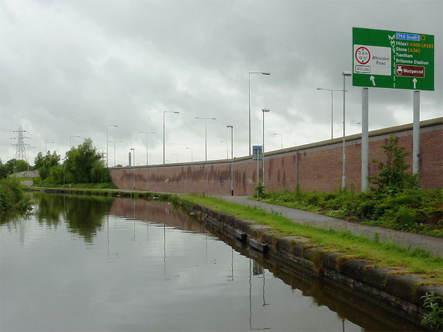
Image: © Roger D Kidd Taken: 30 May 2011
Seen on a dull day after the rain had stopped! Considerable redevelopment has taken place in recent years with many new factory units and multi-lane roads. There are eight lanes of the Queensway A500 behind the wall on the right! The canal is 93.5 miles in length from Derwent Mouth to Preston Brook. The first sod was cut by Josiah Wedgwood in July 1766 at Middleport (Stoke-on-Trent). It took eleven years to build. This section between Derwent Mouth and Shugborough (the junction with the Staffordshire and Worcestershire Canal) was operational by 1770, the rest to Preston Brook being operational by 1777. James Brindley was the engineer until his death in 1772.
Images are licensed for reuse under creativecommons.org/licenses/by-sa/2.0
Image Location
Latitude
53.001294
Longitude
-2.178948