The Town Hall (1), Woodstock
Introduction
The photograph on this page of The Town Hall (1), Woodstock by P L Chadwick as part of the Geograph project.
The Geograph project started in 2005 with the aim of publishing, organising and preserving representative images for every square kilometre of Great Britain, Ireland and the Isle of Man.

There are currently over 7.5m images from over 14,400 individuals and you can help contribute to the project by visiting https://www.geograph.org.uk
The Town Hall (1), Woodstock
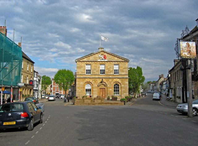
Image: © P L Chadwick Taken: 3 May 2010
On the left is Market Place, leading into Market Street, and on the right is High Street. The Town Hall was built in 1766 to a design by Sir Richard Chambers. Woodstock is much older than the adjoining Blenheim Palace. The town was a borough from 1453, when it obtained a Royal Charter, until the local government re-organisation of 1974. Today the Town Hall is used by Woodstock Town Council, and for functions. Image Image
Images are licensed for reuse under creativecommons.org/licenses/by-sa/2.0
Image Location
Latitude
51.847495
Longitude
-1.356129