Canal Marina south-east of Stafford
Introduction
The photograph on this page of Canal Marina south-east of Stafford by Roger D Kidd as part of the Geograph project.
The Geograph project started in 2005 with the aim of publishing, organising and preserving representative images for every square kilometre of Great Britain, Ireland and the Isle of Man.

There are currently over 7.5m images from over 14,400 individuals and you can help contribute to the project by visiting https://www.geograph.org.uk
Canal Marina south-east of Stafford
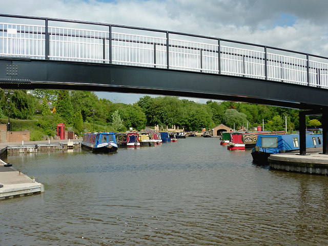
Image: © Roger D Kidd Taken: 31 May 2011
This is the marina of the Stafford Boat Club. Originally it was the short Hazlestrine Arm of the Staffordshire and Worcestershire Canal, which had been used to carry clay to, and bricks from the former Hazlestrine Brickworks. The boat club acquired the site in 1968, and have made a brilliant job of transforming the whole area as a private marina with beautifully landscaped grounds, and club house. The bridge across the entrance is new, built in 2010. Visiting crews are welcomed to the club (especially if supporting the bar!) but it is advisable to contact them first to check whether mooring is available by their field. There is no access from the towpath side.
Images are licensed for reuse under creativecommons.org/licenses/by-sa/2.0
Image Location
Latitude
52.78086
Longitude
-2.088643