
Witton Shields Tower
Introduction
The photograph on this page of Witton Shields Tower by Les Hull as part of the Geograph project.
The Geograph project started in 2005 with the aim of publishing, organising and preserving representative images for every square kilometre of Great Britain, Ireland and the Isle of Man.

There are currently over 7.5m images from over 14,400 individuals and you can help contribute to the project by visiting https://www.geograph.org.uk
Witton Shields Tower
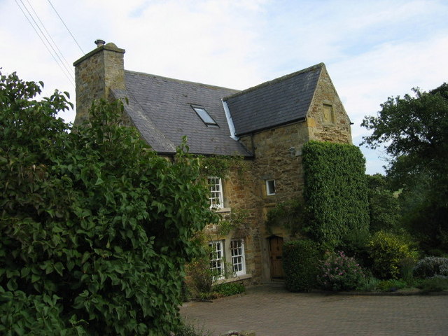
Image: © Les Hull Taken: 20 Sep 2006
The Gatehouse Web Site: King writes this is a C17 domestic building, not a fortified tower. Dodds writes it is a late strong house. PastScape report it as "A bastle or fortified house, probably built in the early C17. A stone inscribed with the date 1608 and the initials N T (Nigel Thornton) is set above the door. The rear extensions were added in 1680 and the building was reduced in height by a storey circa 1914. One of the upper rooms of the house was used as a Roman Catholic chapel in the early C17. The house stands in pastureland, overlooking the dene of the Cowclose Burn on the north side, and the valley of the River Font to the south. It is a strongly constructed building of two storeys with a central stair turret and walls 1 metre thick. The rectangular building is built of stone rubble, with a slate roof." Recorded in survey of 1715 as "a large old building bellonging to Jon. Thornton, esq." SMR report that it is possible there was once a small watchtower on the western side of the roof.
Images are licensed for reuse under creativecommons.org/licenses/by-sa/2.0
Image Location

Latitude
55.2077
Longitude
-1.808266