Plaque on St Mary's Well
Introduction
The photograph on this page of Plaque on St Mary's Well by John S Turner as part of the Geograph project.
The Geograph project started in 2005 with the aim of publishing, organising and preserving representative images for every square kilometre of Great Britain, Ireland and the Isle of Man.

There are currently over 7.5m images from over 14,400 individuals and you can help contribute to the project by visiting https://www.geograph.org.uk
Plaque on St Mary's Well
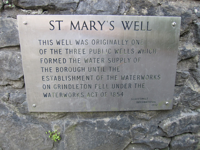
Image: © John S Turner Taken: 28 Apr 2011
The plaque reads: ST MARY'S WELL THIS WELL WAS ORIGINALLY ONE OF THREE PUBLIC WELLS WHICH FORMED THE WATER SUPPLY OF THE BOROUGH UNTIL THE ESTABLISHMENT OF THE WATERWORKS ON GRINDLETON FELL UNDER THE WATERWORKS ACT OF 1854 Soroptomist International 1992 See also Image
Images are licensed for reuse under creativecommons.org/licenses/by-sa/2.0
Image Location
Latitude
53.875009
Longitude
-2.38918