
Near D?n Ch?rlabhaigh
Introduction
The photograph on this page of Near D?n Ch?rlabhaigh by Anne Burgess as part of the Geograph project.
The Geograph project started in 2005 with the aim of publishing, organising and preserving representative images for every square kilometre of Great Britain, Ireland and the Isle of Man.

There are currently over 7.5m images from over 14,400 individuals and you can help contribute to the project by visiting https://www.geograph.org.uk
Near D?n Ch?rlabhaigh
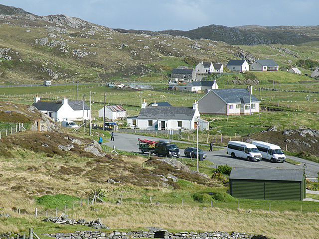
Image: © Anne Burgess Taken: 19 May 2011
The mapped names here are a little confusing. It isn't clear whether the name Dùn Chàrlabhaigh is specific to the broch, or whether it also applies to the neighbouring houses; or whether the latter are regarded as part of Càrlabhagh, the main part of which is a mile or two further north-east. In the foreground is the car park for visitors to the broch. The trailerful of kayaks belonged to a party on an adventure holiday, and the two minibuses brought a party of geologists, both parties taking time to fit the broch into their programmes. The visitor centre is cunningly concealed inside the rocky outcrop on the left.
Images are licensed for reuse under creativecommons.org/licenses/by-sa/2.0
Image Location

Latitude
58.268125
Longitude
-6.79075