Parking area near King William Square
Introduction
The photograph on this page of Parking area near King William Square by Alan Walker as part of the Geograph project.
The Geograph project started in 2005 with the aim of publishing, organising and preserving representative images for every square kilometre of Great Britain, Ireland and the Isle of Man.

There are currently over 7.5m images from over 14,400 individuals and you can help contribute to the project by visiting https://www.geograph.org.uk
Parking area near King William Square
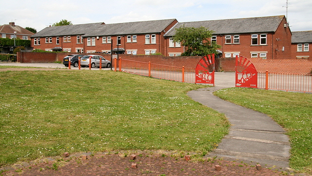
Image: © Alan Walker Taken: 1 Jun 2011
Although not the same prospect this area of Ironville was photographed for the BBC's Domesday Project. Since then the area has undergone some redevelopment. The date in the ironwork ahead, at the end of the footpath, suggests that this happened circa. 2006. Some of the buildings seen in the Domesday photograph have been removed. This photograph was taken from the approximate location of the demolished King William Public House. The stones in the foreground, on the paved area, are cobbles. To see the photograph from the BBC's Domesday Project of this area, click here: http://www.bbc.co.uk/history/domesday/dblock/GB-440000-351000/picture/1 and to see its 2011 equivalent, click here: http://www.geograph.org.uk/photo/2441241 . For another photograph of King William Square, click here: http://www.geograph.org.uk/photo/2441253 . * * * For a local news story (Ripley and Heanor News) describing the removal of the King William Public House that stood on this site, click here: http://www.ripleyandheanornews.co.uk/news/local/king_billy_faces_final_bulldozer_1_718611 . For an interesting collection of much older photographs of the area from the Jacksdale and Westwood Community Website web site, click here: http://www.jacksdale.org.uk/pages/homep/ivkingbillysreet.htm .
Images are licensed for reuse under creativecommons.org/licenses/by-sa/2.0
Image Location
Latitude
53.062021
Longitude
-1.348381