Castell Penrhys / Penrice Castle
Introduction
The photograph on this page of Castell Penrhys / Penrice Castle by Alan Richards as part of the Geograph project.
The Geograph project started in 2005 with the aim of publishing, organising and preserving representative images for every square kilometre of Great Britain, Ireland and the Isle of Man.

There are currently over 7.5m images from over 14,400 individuals and you can help contribute to the project by visiting https://www.geograph.org.uk
Castell Penrhys / Penrice Castle
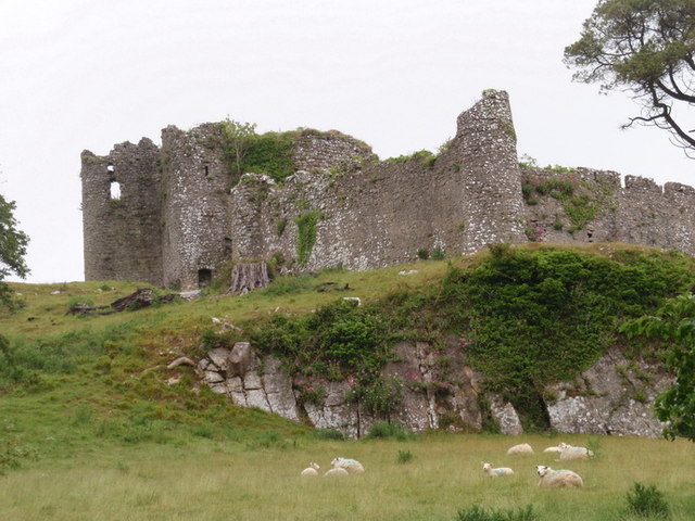
Image: © Alan Richards Taken: 29 May 2011
Castell Penrhys yw amddiffynfa Normanaidd fwyaf ei maint yng Nghwyr. Fe'i codwyd yn ystod canol y 13g yn lle'r amddiffynfa gylch (Monty Bank) a adeiladwyd gerllaw yn ystod degawdau cyntaf y 12g. Roedd Gwyr yn eiddo i dywysogion Deheubarth ac ymgyrchasant yn galed i'w gael yn ol o ddwylo'r goresgynwyr. Yn hanesyddol, felly, dylai'r Ddeddf Uno (1536) fod wedi gosod Arglwyddiaeth Gwyr yn Sir Gaerfyrddin yn hytrach nag yn Sir Forgannwg. Mae'r castell ar dir preifat ac felly nid oes hawl gan y cyhoedd i ymweld ag e. Mae angen gwaith cynnal a chadw arno er mwyn sicrhau ei ddyfodol. Penrice Castle is the largest Norman fortification in Gower. It was built during the mid C13 replacing an early C12 ringwork known as Monty Bank located a short distance away. Gower belonged to the princes of Deheubarth and they led many campaigns in an attempt to wrest it back from the invaders. Historically, therefore, the Act of Union (1536) should have annexed the Lordship of Gower into Carmarthenshire as opposed to Glamorganshire. Penrice Castle is privately owned and therefore there is no public access to the site. Remedial work is required to safeguard its future.
Images are licensed for reuse under creativecommons.org/licenses/by-sa/2.0
Image Location
Latitude
51.574905
Longitude
-4.170748