Peckham Rye station: between the viaducts
Introduction
The photograph on this page of Peckham Rye station: between the viaducts by Christopher Hilton as part of the Geograph project.
The Geograph project started in 2005 with the aim of publishing, organising and preserving representative images for every square kilometre of Great Britain, Ireland and the Isle of Man.

There are currently over 7.5m images from over 14,400 individuals and you can help contribute to the project by visiting https://www.geograph.org.uk
Peckham Rye station: between the viaducts
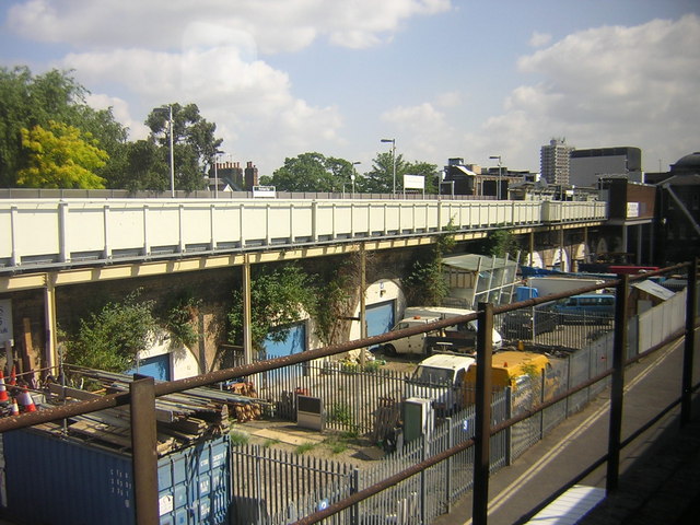
Image: © Christopher Hilton Taken: 2 Jun 2011
Peckham Rye station comprises two separate viaducts with the station building (on the extreme right in this picture) lying between them forming the link. (This reflects its origin as a station shared by two separate railway companies: the London, Chatham and Dover on the northern viaduct, and the London, Brighton and South Coast on the southern one.) Here the view is from a train stopped on the southern viaduct (at an island platform which thus lies behind the photographer), heading into London Bridge (to the right), looking across at the line running from Kent (to the right) into Victoria (to the left). The area between is used by light industry based in the viaduct arches.
Images are licensed for reuse under creativecommons.org/licenses/by-sa/2.0
Image Location


Leaflet Map data © OpenStreetMap
Latitude
51.469945
Longitude
-0.069562