Brigstock: St Andrew
Introduction
The photograph on this page of Brigstock: St Andrew by John Sutton as part of the Geograph project.
The Geograph project started in 2005 with the aim of publishing, organising and preserving representative images for every square kilometre of Great Britain, Ireland and the Isle of Man.

There are currently over 7.5m images from over 14,400 individuals and you can help contribute to the project by visiting https://www.geograph.org.uk
Brigstock: St Andrew
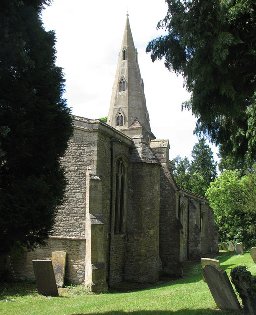
Image: © John Sutton Taken: 1 Jun 2011
The earliest parts of the church date from the late 10th or early 11th centuries, and may incorporate material from an even more ancient church destroyed in the Danish invasions of the 9th century. The north arcade dates from the late 12th century and there is much from the 13th, 14th and 15th centuries, including the broach spire. The church is surrounded by trees, so difficult to photograph in its entirety.
Images are licensed for reuse under creativecommons.org/licenses/by-sa/2.0
Image Location
Latitude
52.456751
Longitude
-0.609374