Camberlot Road
Introduction
The photograph on this page of Camberlot Road by Simon Carey as part of the Geograph project.
The Geograph project started in 2005 with the aim of publishing, organising and preserving representative images for every square kilometre of Great Britain, Ireland and the Isle of Man.

There are currently over 7.5m images from over 14,400 individuals and you can help contribute to the project by visiting https://www.geograph.org.uk
Camberlot Road
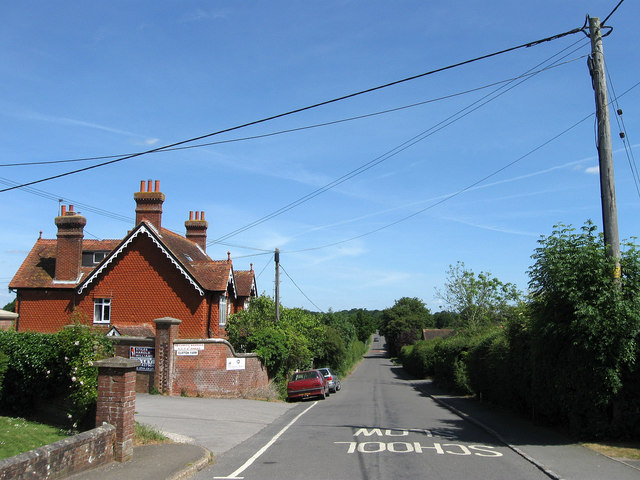
Image: © Simon Carey Taken: 1 Jun 2011
Minor road linking Upper Dicker to the A22. Its straight route is due to it being an enclosure road planned with a ruler by those responsible for enclosing Dicker Common in 1813. The houses on the left are Crossways Cottages built in the first decade of the 20th century to a design made by Sir Horatio Bottomley, who resided in nearby Crossway House and effectively acted as squire to the small village between 1889 when he arrived and 1929 when he departed after his fourth bankruptcy. The drive to Clifton Farm, Bottomley's horse racing stables until 1922, are to the left.
Images are licensed for reuse under creativecommons.org/licenses/by-sa/2.0
Image Location


Leaflet Map data © OpenStreetMap
Latitude
50.868337
Longitude
0.203087