Meadow above Cwm Dulas
Introduction
The photograph on this page of Meadow above Cwm Dulas by Nigel Brown as part of the Geograph project.
The Geograph project started in 2005 with the aim of publishing, organising and preserving representative images for every square kilometre of Great Britain, Ireland and the Isle of Man.

There are currently over 7.5m images from over 14,400 individuals and you can help contribute to the project by visiting https://www.geograph.org.uk
Meadow above Cwm Dulas
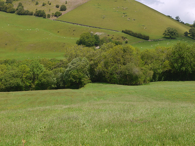
Image: © Nigel Brown Taken: 31 May 2011
The green lump under the trees in the middle of the picture is the railway rank marked on the 1:25000 map, and is the end of the high embankment used by the abandoned northern arm of the Manchester and Milford Railway to cross the Afon Dulas.
Images are licensed for reuse under creativecommons.org/licenses/by-sa/2.0
Image Location
Latitude
52.423065
Longitude
-3.540071