Information board, Mountdrum (1)
Introduction
The photograph on this page of Information board, Mountdrum (1) by Kenneth Allen as part of the Geograph project.
The Geograph project started in 2005 with the aim of publishing, organising and preserving representative images for every square kilometre of Great Britain, Ireland and the Isle of Man.

There are currently over 7.5m images from over 14,400 individuals and you can help contribute to the project by visiting https://www.geograph.org.uk
Information board, Mountdrum (1)
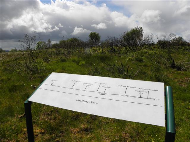
Image: © Kenneth Allen Taken: 30 May 2011
Looking south, some of the places that you could see are Cairnmore, County Monaghan, Slieve Glah in Co Cavan, Slieve Rushen, Lisbellaw, Cuilcagh Mountain Co. Leitrim Hills and Belmore Mountain, but you would need to climb further up to have an un-obscured view.
Images are licensed for reuse under creativecommons.org/licenses/by-sa/2.0
Image Location
Latitude
54.334993
Longitude
-7.528649