
Furness Abbey and the Furness Railway
Introduction
The photograph on this page of Furness Abbey and the Furness Railway by Jonathan Thacker as part of the Geograph project.
The Geograph project started in 2005 with the aim of publishing, organising and preserving representative images for every square kilometre of Great Britain, Ireland and the Isle of Man.

There are currently over 7.5m images from over 14,400 individuals and you can help contribute to the project by visiting https://www.geograph.org.uk
Furness Abbey and the Furness Railway
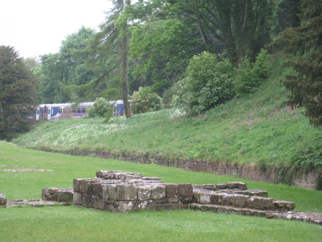
Image: © Jonathan Thacker Taken: 7 May 2011
Many ancient sites in Britain were either obliterated or severely damaged by the building of railways in the nineteenth century. Furness Abbey came close to being one of them. Luckily a short diversion through a tunnel was made rather than running the line directly through the Abbey ruins. Within a year of the opening of the line a station had been opened to serve the Abbey which became a popular excursion destination.
Images are licensed for reuse under creativecommons.org/licenses/by-sa/2.0
Image Location

Latitude
54.136257
Longitude
-3.197472