Canal Street, SE5
Introduction
The photograph on this page of Canal Street, SE5 by Malc McDonald as part of the Geograph project.
The Geograph project started in 2005 with the aim of publishing, organising and preserving representative images for every square kilometre of Great Britain, Ireland and the Isle of Man.

There are currently over 7.5m images from over 14,400 individuals and you can help contribute to the project by visiting https://www.geograph.org.uk
Canal Street, SE5
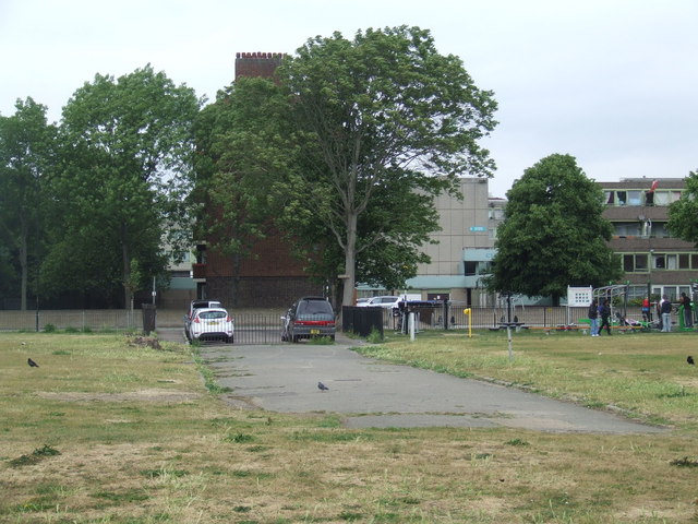
Image: © Malc McDonald Taken: 29 May 2011
Canal Street, as its name suggests, once led to a canal. The canal has been filled in, and the streets, houses and industrial buildings which surrounded it have been demolished. Burgess Park, which is a large park, has been created on the site. Canal Street itself was one of several roads within Burgess Park which had been closed, but not removed. The park is due to receive a major facelift in 2011 and into 2012. This will include removing most of the abandoned roads within the park. In the background are flats belonging to the Aylesbury Estate, a large council estate built in the 1960s and early 1970s. This estate is starting to undergo a major regeneration programme which will take a number of years to complete.
Images are licensed for reuse under creativecommons.org/licenses/by-sa/2.0
Image Location
Latitude
51.482414
Longitude
-0.089631