Grade II listed Lower Eirw Bridge, Trehafod
Introduction
The photograph on this page of Grade II listed Lower Eirw Bridge, Trehafod by Jaggery as part of the Geograph project.
The Geograph project started in 2005 with the aim of publishing, organising and preserving representative images for every square kilometre of Great Britain, Ireland and the Isle of Man.

There are currently over 7.5m images from over 14,400 individuals and you can help contribute to the project by visiting https://www.geograph.org.uk
Grade II listed Lower Eirw Bridge, Trehafod
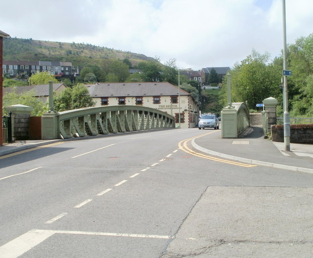
Image: © Jaggery Taken: 6 May 2011
The bridge carries Trehafod Road over the River Rhondda. A plaque http://www.geograph.org.uk/photo/2428818 on the bridge records that the bridge was widened in 1907 and reconstructed (in the form seen here) in 1927. The bridge was made by the Horsehay Company Ltd of Horsehay, Image Shropshire. The bridge was Grade II listed in 1996. The large building on the far side of the bridge is The Bertie. http://www.geograph.org.uk/photo/2428647
Images are licensed for reuse under creativecommons.org/licenses/by-sa/2.0
Image Location
Latitude
51.609654
Longitude
-3.384859