The Victoria (1), 42-46 Dock Street, Fleetwood
Introduction
The photograph on this page of The Victoria (1), 42-46 Dock Street, Fleetwood by P L Chadwick as part of the Geograph project.
The Geograph project started in 2005 with the aim of publishing, organising and preserving representative images for every square kilometre of Great Britain, Ireland and the Isle of Man.

There are currently over 7.5m images from over 14,400 individuals and you can help contribute to the project by visiting https://www.geograph.org.uk
The Victoria (1), 42-46 Dock Street, Fleetwood
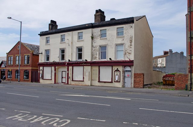
Image: © P L Chadwick Taken: 6 May 2011
A closed pub, which claimed to be the oldest pub in Fleetwood, according to the faded signage on the building. There seems to be some suggestion that it may be turned into flats, but this may not have been decided. It would need planning permission to change the use. Image It should be said that a boundary between OS squares goes right across this pub, but as the majority of it seems to be in SD3347, according to the website "Where's the Path?", that is where I have put it. Also the small scale of the OS map for this square, makes it look as if the pub is on the east side of Dock Road, but it is actually on the west side.
Images are licensed for reuse under creativecommons.org/licenses/by-sa/2.0
Image Location
Latitude
53.9231
Longitude
-3.006645