Excavation at Tolastadh
Introduction
The photograph on this page of Excavation at Tolastadh by Anne Burgess as part of the Geograph project.
The Geograph project started in 2005 with the aim of publishing, organising and preserving representative images for every square kilometre of Great Britain, Ireland and the Isle of Man.

There are currently over 7.5m images from over 14,400 individuals and you can help contribute to the project by visiting https://www.geograph.org.uk
Excavation at Tolastadh
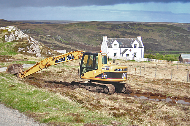
Image: © Anne Burgess Taken: 14 May 2011
I understand that the digger is preparing a site for a wind turbine. There are to be two, one at each end of the village, to supply power to the residents.
Images are licensed for reuse under creativecommons.org/licenses/by-sa/2.0
Image Location
Latitude
58.355659
Longitude
-6.219142