Curzon Street, Netherfield
Introduction
The photograph on this page of Curzon Street, Netherfield by Alan Murray-Rust as part of the Geograph project.
The Geograph project started in 2005 with the aim of publishing, organising and preserving representative images for every square kilometre of Great Britain, Ireland and the Isle of Man.

There are currently over 7.5m images from over 14,400 individuals and you can help contribute to the project by visiting https://www.geograph.org.uk
Curzon Street, Netherfield
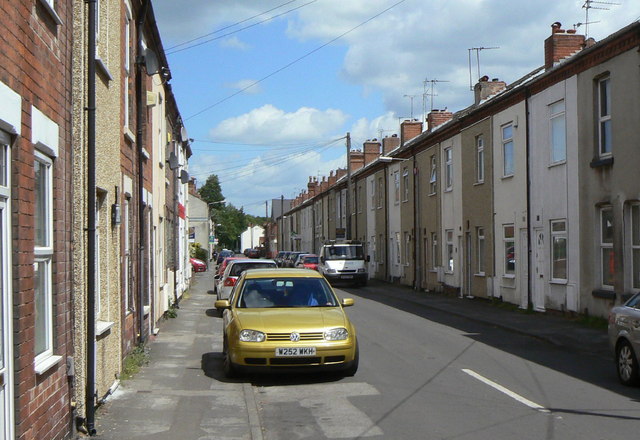
Image: © Alan Murray-Rust Taken: 24 May 2011
Taken specifically for comparison with the image in Domesday Reloaded http://www.bbc.co.uk/history/domesday/dblock/GB-460000-339000/picture/1 . As the caption there states, this is a typical Netherfield Street, and it took a bit of research to decide exactly which street it was. The taller building just visible further down the left hand side of the street in the older picture (possibly industrial premises) has now been replaced with more modern housing. The main change is the increase in the number of parked cars.
Images are licensed for reuse under creativecommons.org/licenses/by-sa/2.0
Image Location
Latitude
52.963302
Longitude
-1.074673