Windyridge
Introduction
The photograph on this page of Windyridge by Anne Burgess as part of the Geograph project.
The Geograph project started in 2005 with the aim of publishing, organising and preserving representative images for every square kilometre of Great Britain, Ireland and the Isle of Man.

There are currently over 7.5m images from over 14,400 individuals and you can help contribute to the project by visiting https://www.geograph.org.uk
Windyridge
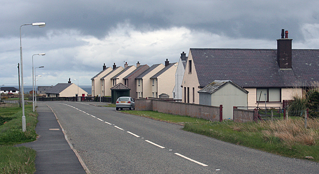
Image: © Anne Burgess Taken: 13 May 2011
This very English name is quite appropriate. The main road from Steòrnabhagh, the A866, runs past a small estate of council houses, instantly recognisable because their style or architecture not only differs from the traditional houses in the area, but also because it is the same all over the country.
Images are licensed for reuse under creativecommons.org/licenses/by-sa/2.0
Image Location
Latitude
58.241696
Longitude
-6.165332