Kent Road, Congresbury
Introduction
The photograph on this page of Kent Road, Congresbury by Derek Harper as part of the Geograph project.
The Geograph project started in 2005 with the aim of publishing, organising and preserving representative images for every square kilometre of Great Britain, Ireland and the Isle of Man.

There are currently over 7.5m images from over 14,400 individuals and you can help contribute to the project by visiting https://www.geograph.org.uk
Kent Road, Congresbury
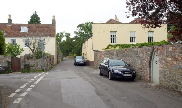
Image: © Derek Harper Taken: 16 May 2011
The B3169 at the junction with Smallway, connecting to the A370. Kent Road must have once been the main road through Congresbury - see http://www.sabre-roads.org.uk/wiki/index.php?title=B3169 for a discussion of relevant road numbering. The house on the right is "The Old Malthouse" - I like the Gothic door in the wall. As Cypress Lodge, this was a Quaker meeting house in the mid-C19 http://www.claverhammeetinghouse.org.uk/news/2010/4/28/metfords-of-claverham-meeting.html .
Images are licensed for reuse under creativecommons.org/licenses/by-sa/2.0
Image Location
Latitude
51.372899
Longitude
-2.80777