Former Barbour's Mill, Hilden (7)
Introduction
The photograph on this page of Former Barbour's Mill, Hilden (7) by Albert Bridge as part of the Geograph project.
The Geograph project started in 2005 with the aim of publishing, organising and preserving representative images for every square kilometre of Great Britain, Ireland and the Isle of Man.

There are currently over 7.5m images from over 14,400 individuals and you can help contribute to the project by visiting https://www.geograph.org.uk
Former Barbour's Mill, Hilden (7)
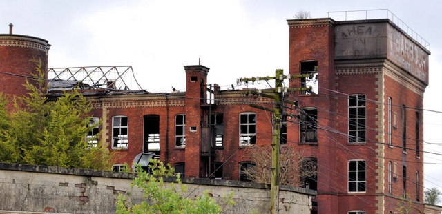
Image: © Albert Bridge Taken: 22 May 2011
See Image This view is from Bridge Street, Hilden about 15 minutes after the previous one, by which time two fire appliances had arrived. A “before” view of this part of the former mill can be seen at upper middle in Image
Images are licensed for reuse under creativecommons.org/licenses/by-sa/2.0
Image Location
Latitude
54.519436
Longitude
-6.022207