The Red Store beside the river at Lerryn
Introduction
The photograph on this page of The Red Store beside the river at Lerryn by Rod Allday as part of the Geograph project.
The Geograph project started in 2005 with the aim of publishing, organising and preserving representative images for every square kilometre of Great Britain, Ireland and the Isle of Man.

There are currently over 7.5m images from over 14,400 individuals and you can help contribute to the project by visiting https://www.geograph.org.uk
The Red Store beside the river at Lerryn
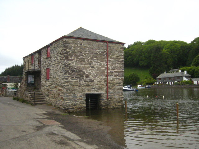
Image: © Rod Allday Taken: 17 May 2011
The Grade II Listed Red Store was built in about 1870 as a storehouse for goods such as fertiliser and corn that were shipped up and down the River Lerryn until the early 20th Century. During the Second World War it was used to store salvage to help the war effort and in the 1950s the top floor was used as a youth club. The building fell into disuse and was purchased by the Parish Council in 2002 for renovation and refurbishment to provide a community facility comprising two craft workshops on the top floor and on the lower floor a flexible multi-use area.
Images are licensed for reuse under creativecommons.org/licenses/by-sa/2.0
Image Location
Latitude
50.382823
Longitude
-4.619442