Cyprus DLR Station
Introduction
The photograph on this page of Cyprus DLR Station by Des Blenkinsopp as part of the Geograph project.
The Geograph project started in 2005 with the aim of publishing, organising and preserving representative images for every square kilometre of Great Britain, Ireland and the Isle of Man.

There are currently over 7.5m images from over 14,400 individuals and you can help contribute to the project by visiting https://www.geograph.org.uk
Cyprus DLR Station
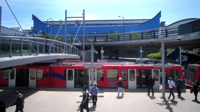
Image: © Des Blenkinsopp Taken: 3 May 2011
The Docklands Light Railway runs along the centre of the highway along this stretch and two stations are located beneath elevated road roundabouts. Rather tricky to photograph in any sort of entirety without standing on the tracks or in the road, but you can see a section of the roundabout with a walkway over the tracks and under the road leading to the University of East London buildings in the background.
Images are licensed for reuse under creativecommons.org/licenses/by-sa/2.0
Image Location
Latitude
51.508496
Longitude
0.06407