
Craigcrook Castle
Introduction
The photograph on this page of Craigcrook Castle by kim traynor as part of the Geograph project.
The Geograph project started in 2005 with the aim of publishing, organising and preserving representative images for every square kilometre of Great Britain, Ireland and the Isle of Man.

There are currently over 7.5m images from over 14,400 individuals and you can help contribute to the project by visiting https://www.geograph.org.uk
Craigcrook Castle
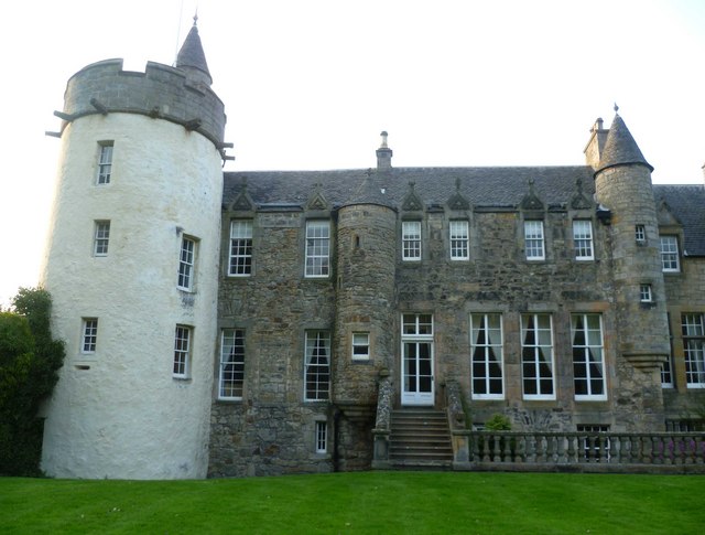
Image: © kim traynor Taken: 20 Apr 2011
The rear view from the 17thC walled south garden. The building followed a Z-arrangement, comprising the main block flanked by a projecting round tower to the south west and a square stair-tower to the north-east, the latter, containing the original entrance, is now encased in later rebuilding. Access to the upper stories was by turret stairs. Many of the alterations were carried out by William Playfair. The large windows seen here belie its original defensive character. http://en.wikipedia.org/wiki/Craigcrook_Castle
Images are licensed for reuse under creativecommons.org/licenses/by-sa/2.0
Image Location

Latitude
55.95477
Longitude
-3.265178