Huddersfield Narrow Canal, Paddock Foot
Introduction
The photograph on this page of Huddersfield Narrow Canal, Paddock Foot by Chris Allen as part of the Geograph project.
The Geograph project started in 2005 with the aim of publishing, organising and preserving representative images for every square kilometre of Great Britain, Ireland and the Isle of Man.

There are currently over 7.5m images from over 14,400 individuals and you can help contribute to the project by visiting https://www.geograph.org.uk
Huddersfield Narrow Canal, Paddock Foot
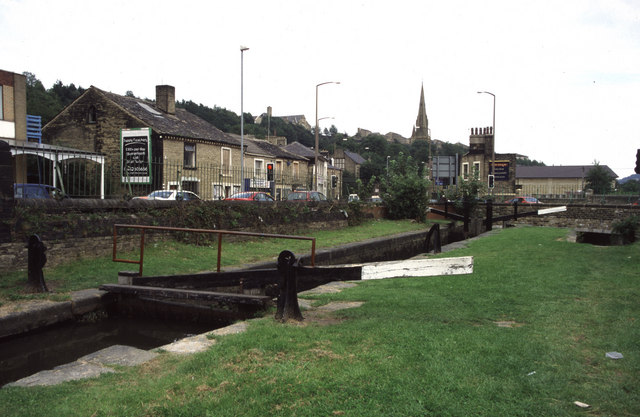
Image: © Chris Allen Taken: 17 Aug 2002
Longroyd Lane is on the left and Manchester Road (A62) is crossing the canal just beyond the lock. The distant church spire is on a church that was associated with a huge textile complex (Starkey's Mill) that was demolished before I thought of photographing it. I grew up in this area.
Images are licensed for reuse under creativecommons.org/licenses/by-sa/2.0
Image Location
Latitude
53.6416
Longitude
-1.796221