Paths at Killams
Introduction
The photograph on this page of Paths at Killams by Derek Harper as part of the Geograph project.
The Geograph project started in 2005 with the aim of publishing, organising and preserving representative images for every square kilometre of Great Britain, Ireland and the Isle of Man.

There are currently over 7.5m images from over 14,400 individuals and you can help contribute to the project by visiting https://www.geograph.org.uk
Paths at Killams
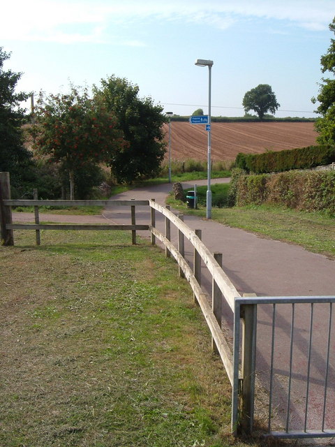
Image: © Derek Harper Taken: 16 Sep 2006
Combined foot- and cyclepaths have been built around the edge of the estate on the southern edge of Taunton's suburbs. This photo is taken from Killams Avenue, and there is modern housing to the right and left. The parapets just beyond the waste bin indicate the crossing of the Black Brook, which flows to the right. Ahead is farmland in the direction of Cutliff Farm.
Images are licensed for reuse under creativecommons.org/licenses/by-sa/2.0
Image Location


Leaflet Map data © OpenStreetMap
Latitude
50.998325
Longitude
-3.090677