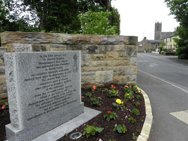
Inscribed stone, Donaghmore (2)
Introduction
The photograph on this page of Inscribed stone, Donaghmore (2) by Kenneth Allen as part of the Geograph project.
The Geograph project started in 2005 with the aim of publishing, organising and preserving representative images for every square kilometre of Great Britain, Ireland and the Isle of Man.
There are currently over 7.5m images from over 14,400 individuals and you can help contribute to the project by visiting https://www.geograph.org.uk

Image: © Kenneth Allen Taken: 16 May 2011
Looking east towards the town; the following text is included, "In the 5th Century AD, St Patrick founded Donaghmore's first church and appointed Colm Cruimther as Parish Priest. An extensive monastic settlement thrived there until its destruction in 1195. The nearby High Cross comprises parts of crosses once placed as boundary markers of the monastery. From the eleventh Century until the flight of the Earls in 1607, Donaghmore was the property of the O'Neill clan. The subsequent Plantation of Ulster introduced different landlords, and new entrepreneurs contributed to the development of this historical site"

