Coggleshall from the air
Introduction
The photograph on this page of Coggleshall from the air by Thomas Nugent as part of the Geograph project.
The Geograph project started in 2005 with the aim of publishing, organising and preserving representative images for every square kilometre of Great Britain, Ireland and the Isle of Man.

There are currently over 7.5m images from over 14,400 individuals and you can help contribute to the project by visiting https://www.geograph.org.uk
Coggleshall from the air
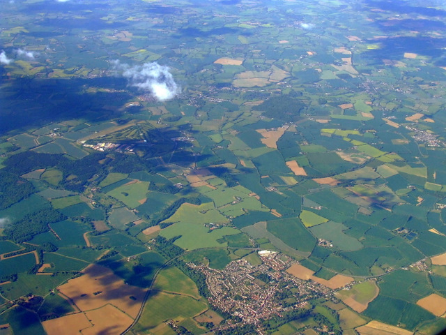
Image: © Thomas Nugent Taken: 9 May 2011
The former RAF Earls Colne Airfield (now mostly a golf course) can be seen to the left of centre of the photo. Here is a http://en.wikipedia.org/wiki/Earls_Colne_Airfield to the wikipedia article about Earls Colne Airfield.
Images are licensed for reuse under creativecommons.org/licenses/by-sa/2.0
Image Location
Latitude
51.870555
Longitude
0.678548