West Worlington
Introduction
The photograph on this page of West Worlington by Derek Harper as part of the Geograph project.
The Geograph project started in 2005 with the aim of publishing, organising and preserving representative images for every square kilometre of Great Britain, Ireland and the Isle of Man.

There are currently over 7.5m images from over 14,400 individuals and you can help contribute to the project by visiting https://www.geograph.org.uk
West Worlington
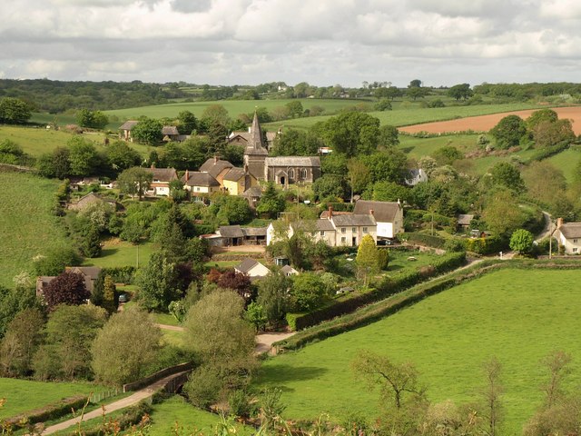
Image: © Derek Harper Taken: 12 May 2011
The village seen across the Little Dart valley from East Worlington Footpath 5. An easting gridline cuts across the scene, passing through the right-hand ends of the church and of the Stucley Arms, the cream building right of centre. West Worlington Bridge across the Little Dart can be seen near bottom left.
Images are licensed for reuse under creativecommons.org/licenses/by-sa/2.0
Image Location
Latitude
50.906907
Longitude
-3.752195