
Looking across to Pontiago
Introduction
The photograph on this page of Looking across to Pontiago by Natasha Ceridwen de Chroustchoff as part of the Geograph project.
The Geograph project started in 2005 with the aim of publishing, organising and preserving representative images for every square kilometre of Great Britain, Ireland and the Isle of Man.

There are currently over 7.5m images from over 14,400 individuals and you can help contribute to the project by visiting https://www.geograph.org.uk
Looking across to Pontiago
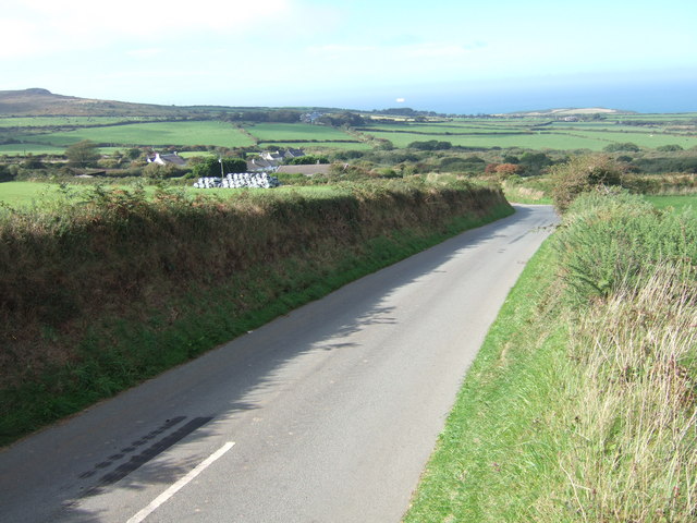
Image: © Natasha Ceridwen de Chroustchoff Taken: 15 Sep 2006
Pontiago is no more than a cluster of houses on the exposed headland of Pencaer, west of Fishguard. The land here has been settled since prehistoric times but there are no villages, only dispersed farms, cottages and a couple of tiny hamlets of which this is one. With sea to the north and west, the high boundary banks, as seen beside the road here, provide some protection from the wind.
Images are licensed for reuse under creativecommons.org/licenses/by-sa/2.0
Image Location

Latitude
52.008667
Longitude
-5.027714