Victoria Street, Belfast (3)
Introduction
The photograph on this page of Victoria Street, Belfast (3) by Albert Bridge as part of the Geograph project.
The Geograph project started in 2005 with the aim of publishing, organising and preserving representative images for every square kilometre of Great Britain, Ireland and the Isle of Man.

There are currently over 7.5m images from over 14,400 individuals and you can help contribute to the project by visiting https://www.geograph.org.uk
Victoria Street, Belfast (3)
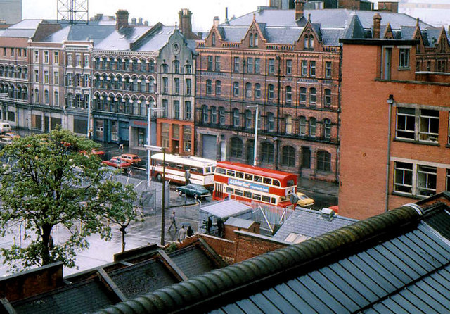
Image: © Albert Bridge Taken: 25 May 1976
All the buildings, in this view of Victoria Street, have now vanished. Those in the background were demolished as described in Image Those in the foreground (including the building from which the photograph was taken) went under the bulldozer for the Victoria Square development Image In the days before the Westlink Image and the M3 Image, all traffic from the south to the north and north Down passed along Victoria Street (much quieter now). Finally, just below the double-deck bus, there was a security checkpoint where all vehicles and pedestrians, entering “The Segments” Image were searched. There is no equivalent in 2011. This is an approximate “then and now” Image
Images are licensed for reuse under creativecommons.org/licenses/by-sa/2.0
Image Location
Latitude
54.598647
Longitude
-5.923506