Tilbury Trough
Introduction
The photograph on this page of Tilbury Trough by Glyn Baker as part of the Geograph project.
The Geograph project started in 2005 with the aim of publishing, organising and preserving representative images for every square kilometre of Great Britain, Ireland and the Isle of Man.

There are currently over 7.5m images from over 14,400 individuals and you can help contribute to the project by visiting https://www.geograph.org.uk
Tilbury Trough
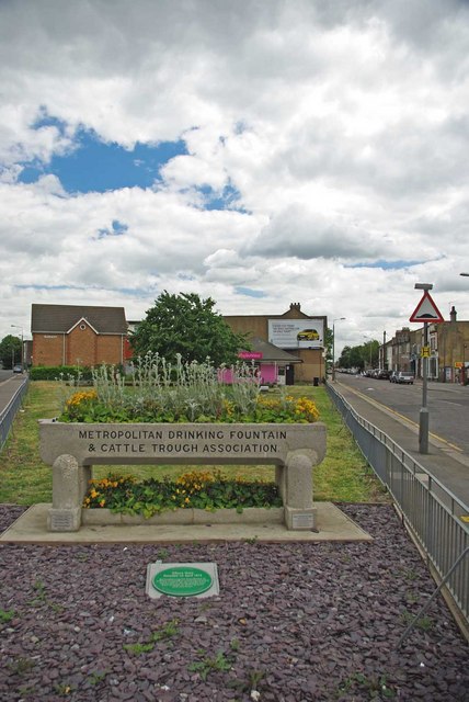
Image: © Glyn Baker Taken: 14 May 2011
This cattle trough is at a fork in the road wilh Calcutta Rd to the left and Dock Rd to the right. It was erected to mark the incorporation of Tilbury in 1912 see the dedication at Image for more info on the association see http://en.wikipedia.org/wiki/Metropolitan_Drinking_Fountain_and_Cattle_Trough_Association or http://www.drinkingfountains.org/main.html
Images are licensed for reuse under creativecommons.org/licenses/by-sa/2.0
Image Location
Latitude
51.462076
Longitude
0.355953