Willesden Bus Garage
Introduction
The photograph on this page of Willesden Bus Garage by David Hawgood as part of the Geograph project.
The Geograph project started in 2005 with the aim of publishing, organising and preserving representative images for every square kilometre of Great Britain, Ireland and the Isle of Man.

There are currently over 7.5m images from over 14,400 individuals and you can help contribute to the project by visiting https://www.geograph.org.uk
Willesden Bus Garage
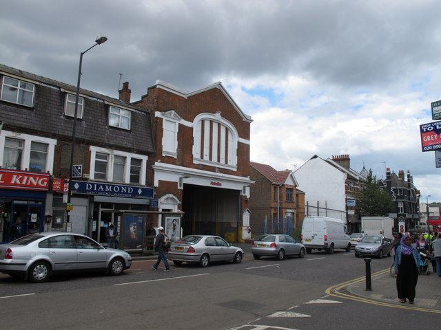
Image: © David Hawgood Taken: 12 May 2011
This photo is for BBC Domesday Reloaded as a recreation of a 1986 photo http://www.bbc.co.uk/history/domesday/dblock/GB-520000-183000/picture/3 . The entrance onto High Road looks much the same as in 1986. The 1986 photo had "London Transport" above the main bus entrance, now it has "Metroline" who run buses under contract to Transport for London. The first floor windows were clear in 1986, now they are blocked. The big difference is behind the entrance. See aerial photos on one of the mapping links http://www.geograph.org.uk/gridref/TQ2184/links , e.g. on www.bing.com http://www.bing.com/maps/explore/?org=aj#5003/s=w/5872/style=be&lat=skr6h7&lon=gzd134&alt=86.919022&z=17&pid=5874 . It is site with large buildings and many double deck buses parked.
Images are licensed for reuse under creativecommons.org/licenses/by-sa/2.0
Image Location
Latitude
51.54836
Longitude
-0.238096