Channel Tunnel Rail Link Works, King's Cross
Introduction
The photograph on this page of Channel Tunnel Rail Link Works, King's Cross by Stephen McKay as part of the Geograph project.
The Geograph project started in 2005 with the aim of publishing, organising and preserving representative images for every square kilometre of Great Britain, Ireland and the Isle of Man.

There are currently over 7.5m images from over 14,400 individuals and you can help contribute to the project by visiting https://www.geograph.org.uk
Channel Tunnel Rail Link Works, King's Cross
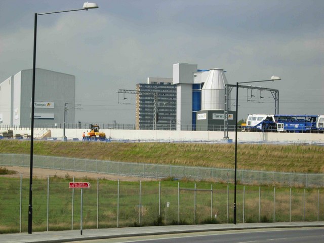
Image: © Stephen McKay Taken: 13 Sep 2006
This shows the alignment of the Channel Tunnel Rail Link at the point where it curves round into St Pancras station, which is now at an advanced stage of construction. This area has changed radically in recent years, the old railway sidings that used to occupy the land have now disappeared, and York Way (from where the picture was taken) follows a new sweeping curve under the rail link.
Images are licensed for reuse under creativecommons.org/licenses/by-sa/2.0
Image Location
Latitude
51.539039
Longitude
-0.126916