Limekiln, Low Sealhouse Farm
Introduction
The photograph on this page of Limekiln, Low Sealhouse Farm by Maigheach-gheal as part of the Geograph project.
The Geograph project started in 2005 with the aim of publishing, organising and preserving representative images for every square kilometre of Great Britain, Ireland and the Isle of Man.

There are currently over 7.5m images from over 14,400 individuals and you can help contribute to the project by visiting https://www.geograph.org.uk
Limekiln, Low Sealhouse Farm
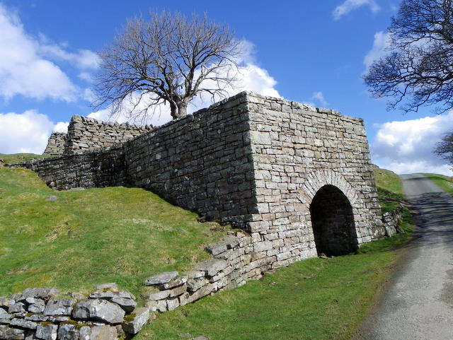
Image: © Maigheach-gheal Taken: 3 Apr 2011
In the 18th and 19th centuries, when lime was extensively used on acid clay soil to improve cultivation, lime kilns were widespread. Beehive shaped, with a hole in the top, kilns were usually built on the sides of steep hills and against cliff faces, to make the loading of limestone and coal easier. Alternating layers of limestone and coal were burnt to produce the lime. This kiln dates from the early 19th century.
Images are licensed for reuse under creativecommons.org/licenses/by-sa/2.0
Image Location
Latitude
54.435645
Longitude
-2.018929